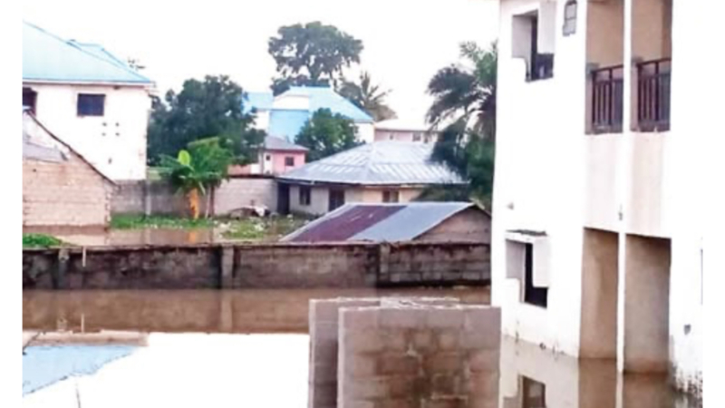
The Nigeria Hydrological Services Agency says its latest monitoring shows high water levels along parts of the River Niger and River Benue, with the possibility of flooding in Kogi, Anambra, and Delta states.
NiHSA also predicted potential flooding in Benue, Adamawa, Niger, and Bayelsa states.
The agency added that a recent assessment of water quality during flood evaluation exercises revealed contamination in some shallow wells caused by floodwater intrusion.
The Director General and Chief Executive Officer of NiHSA, Umar Muhammed, disclosed this at a press briefing in Abuja on Thursday.
“At the moment, our hydrological monitoring shows high water levels along parts of the Niger and Benue Rivers, with the possibility of localised flooding in Kogi, Anambra, and Delta states.
We advise residents in flood-prone areas to remain vigilant and follow official advisories,” Muhammed said.
“Our recent water quality assessment during flood evaluation exercises revealed contamination in some shallow wells caused by floodwater intrusion. We call for stronger collaboration among relevant ministries, humanitarian partners, and local authorities to ensure the provision of safe drinking water to affected communities.”
The latest warning from NiHSA underscores ongoing concerns about the country’s flood preparedness and resilience amid climate change.
The alert serves as both a precaution and a call for coordinated action among federal, state, and local authorities to mitigate the anticipated impacts.
Muhammed further noted that the agency is developing a Five-Year Strategic Action Plan to guide its operations, focusing on innovation, regional empowerment, and stronger stakeholder engagement.
“NiHSA is also strengthening its zonal and field offices to bring our services closer to the people. All these efforts are in line with the Renewed Hope Agenda of President Bola Ahmed Tinubu, which emphasizes innovation, accountability, and measurable results,” he said.
Muhammed reaffirmed the agency’s commitment to adopting a proactive, data-driven approach aimed at saving lives, protecting infrastructure, and strengthening Nigeria’s resilience to the impacts of climate change.
He added that NiHSA had expanded real-time data collection and upgraded its early warning systems, with forecasts now backed by satellite imagery, digital modeling, and on-ground measurements to better predict and communicate flood risks.
“Across the country, NiHSA maintains a wide network of hydrological and groundwater monitoring stations. These provide real-time information for forecasting, planning, and decision-making. Through hydrogeological mapping, river discharge measurements, and floodplain studies, we help states and local communities make informed choices about land use, infrastructure, and water management,” he explained.
The DG also noted that the Annual Flood Outlook remains one of the agency’s flagship products, forecasting likely flood scenarios across all states each year and guiding national and local preparedness efforts.
He emphasized that collaboration remains central to NiHSA’s operations, highlighting robust partnerships with national institutions such as the Nigerian Meteorological Agency, the National Emergency Management Agency, and the National Water Resources Institute, as well as with regional and international organizations including the Lake Chad Basin Commission, Niger Basin Authority Operational Support System, the World Meteorological Organization, the United Nations Educational, Scientific and Cultural Organization, the Economic Community of West African States, and the International Atomic Energy Agency, which help build capacity, strengthen coordination, and align the agency’s work with global best practices.